How to Use the Wildfire List
Premium-only feature
- How to View the Wildfire List
- How to View Wildfire Details
- Searching the Wildfire List
- Filtering the Wildfires
- Sorting the Wildfire List
- Hide the Wildfire List
How to View the Wildfire List
The headings at the top of the list enable you to toggle between the Earthquake and Wildfire lists. Tap the Wildfires heading to view the Wildfires List.
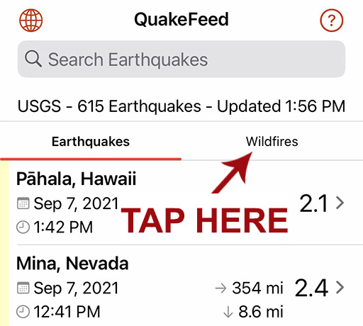
The Wildfire List is sorted by size by default, but you can change the sort order.
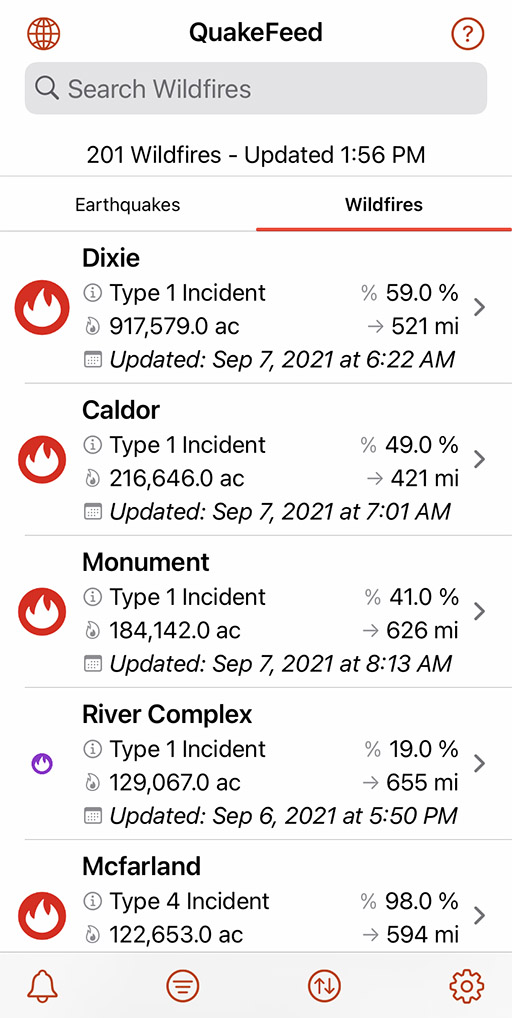
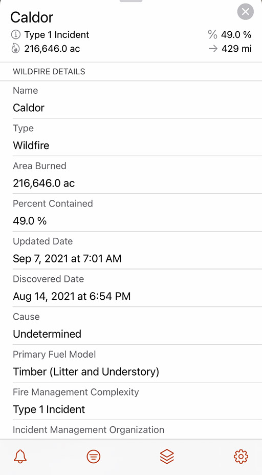
How to View Wildfire Details
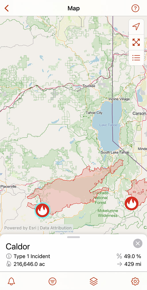
Tap on a wildfire to view its location on the map and its details.
Tap or pull up on the sliding panel to view more details, such as the number of firefighters, number of buildings destroyed, etc.
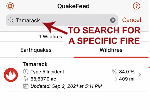
Searching the Wildfire List
The search box at the top of the Wildfire List enables you to search for a wildfire by name. You can also filter the list for a specific state by typing the state's two letter abbreviation in ( ). For example, (CA), (ID), or (TX).
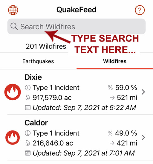
Type a wildfire name in the gray box and the list will be filtered by your search.
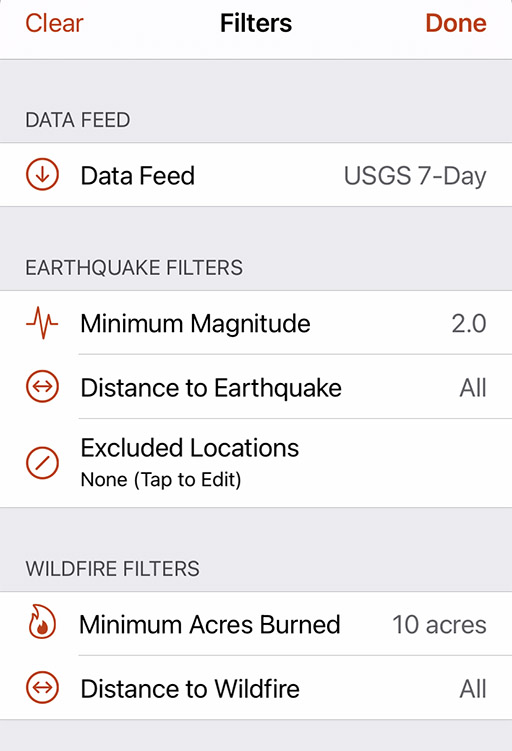
Filtering the Wildfires
The Wildfire List can be filtered by Minimum Acres Burned or Distance from your location.
Tap second button from left to display Filter options. You can filter Wildfires by Minimum Acres Burned and Distance from your location. This will filter the list and the map.
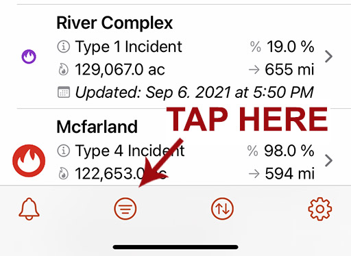
Sorting the Wildfire List
You can sort the Wildfire List by Acres Burned, Distance from your location, Alphabetically by name, or the Updated Date.
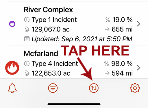
Tap second button from right to display Sort options.
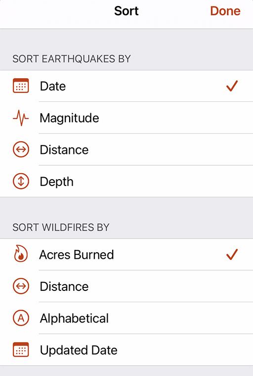
You can sort Wildfires by Acres Burned, Distance from your location, Alphabetically, or by the Updated Date.
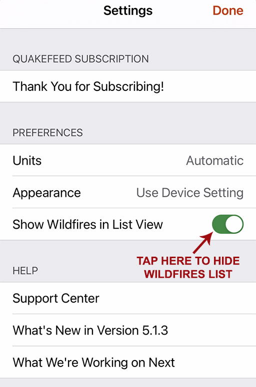
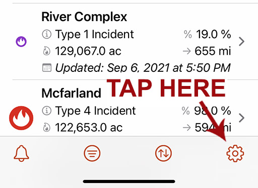
Hiding the Wildfire List
Tap the Settings button (bottom right) then turn off the Show Wildfires in List View setting.
Toggle the Wildfires List on / off here. The wildfires will still display on the map unless you also turn off the Wildfires map layer.